Mapping a mystery
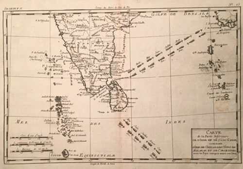
1780 map by Bonne showing trade winds
The various names of
Sri Lanka over the centuries gave cartographers working before modern communications and satellite imagery, a mystery to solve. What was the island’s correct name? And since maps depended on sketches and recollections by ancient mariners as interpreted by the cartographer, they were not completely accurate.
Early maps of Sri Lanka published in the 15th and 16th centuries were printed on vellum from wooden blocks or copper plates on which the map was etched. The background was cut away leaving the design and lettering standing out in relief. A map depended on the etcher’s skill as well as on the limited information available.
The classic 16th Century map of Asia by the German cartographer Sebastian Munster (1488-1552) is the earliest printed map of the continent. It first appeared in the 1540 edition of Ptolemy’s Geography but the information incorporated on it was derived from reports of the travels for 24 years in Asia by Marco Polo (1254-1324) two centuries before. Munster’s map has Sri Lanka (as Zaylon representing the Portuguese name Ceilão) correctly positioned at the eastern tip of India, while the name Taprobana is given to an island where today’s Sumatra is located.
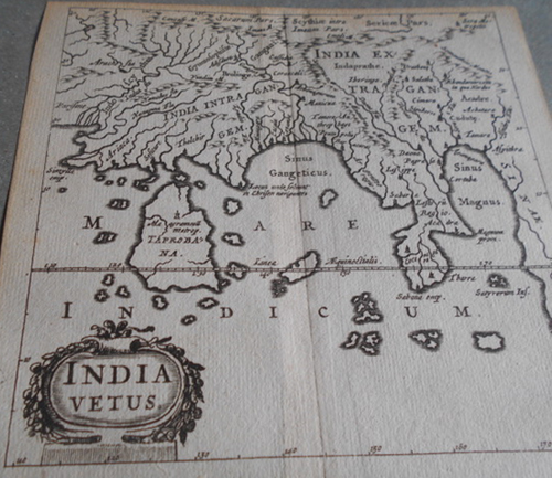
1661 map (detail) by Culver showing Sri Lanka as Taprobana
However, historians have suggested that the name Taprobana was a Greek or Roman alteration of Tambapanni, the name given to Sri Lanka by Prince Vijaya. Perhaps that is why, after Munster’s map was published, cartographers erased Zaylon and named the island Taprobana. A fine example is a very rare copper plate map by German cartographer and historian, Philipp Culver (1580-1622)which was published in 1661 after his death. Entitled “India Vetus” (Old India) it shows Taprobana at the southern tip of (and larger than) India and with the Equator running through it.
However, later cartographers seem to have been better informed and found a neat solution to the mystery of the island’s name.Thus, French cartographer, Alain Mallet (1630-1706), in his 1683 map gave Sri Lanka two names, Ceilan and Taprobana. Another French cartographer, Pierre Du Val (1619-1683), had already decided in 1676 that the island was called Ceilan. His miniature map published 345 years ago is picturesque and detailed with “Pico de Adam” prominent among the drawings of many mountains.
In 1780 a fascinating map of the region was created by Rigobert Bonne (1727-1794), the royal cartographer of France. Not only is it amazingly accurate in its depiction of Ceylan and its towns, it also features arrows showing the direction of prevailing trade winds during the months of the dry and monsoon seasons.
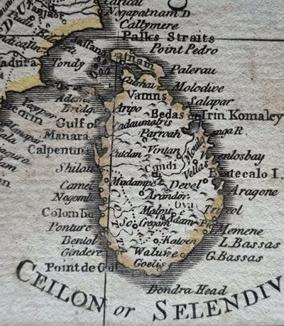
1782 Ceilan or Selandiva detail
However, to add to the mystery of the island’s name, a map by Thomas Kitchin published in London in 1782 gives Sri Lanka the British name of Ceilon, adding “or Selandiva.”
In the 19th Century,when the lithograph method of printing was introduced, maps become more detailed, bearing a resemblance to modern printed maps. Because of this, 19th Century maps are collected and valued for what they reveal of the information available when the map was printed, rather than for the antique or artistic appeal of hand-etched maps.
A fine example is the lithograph map of “Island of Ceylon” by G. H. Swanston published in 1856. The figures on this rare map denote the height in feet from Frazer’s Trigonometrical Survey of the Kandyan districts of 1845. Of special interest to railway enthusiasts is the trace of the proposed railway line from Colombo to Kandy, which was not completed until 21 years after publication of the map.
Also illustrating the progress of the spread of the railways is a printed map of Ceylon published in England by Edward Stanford in 1882. This hand coloured map shows the railways reaching Kurunegala and Kandy, with branches to Matale and Nawalapitiya, and down the west coast from Colombo terminating at Kalutara. A more detailed map of Ceylon published in the USA in 1895 is interesting as it shows longitude east from Washington, as well as the same reach of the railways.
Because they were printed overseas, genuine antique maps of Sri Lanka are rarely found here. However, there are dealers in Europe and Singapore specialising in antique maps, including maps showingthe mysterious Taprobana. They make a fascinating link with the past to bring home to
Sri Lanka.
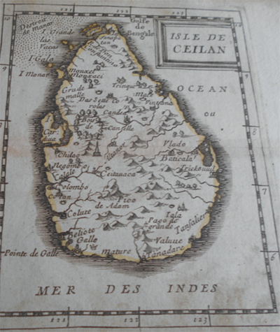
1676 map of Ceilan by Du Val
