News
Special reports – Floods
View(s):
Kolonnawa
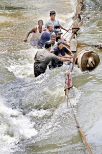
Sedawatte

Kaduwela
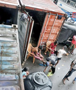
Close to the Kelaniya bridge
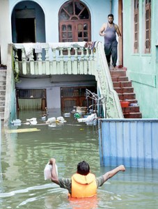
Angoda
Kelani crisis largely man-made
By Anushiya Sathisraja
Shrinking open spaces, illegal constructions, the lack of proper waste disposal and inefficient drainage systems contributed to the worst flooding in 27 years in Colombo and its suburbs, a senior official of the Irrigation Department said.
People filling up lowlands for construction and choked stormwater drains and other water conduits deepened the crisis.
Clogged drainage and canals in and around the city are blocking the flow of water to the river and sea, Irrigation Department Acting Director-General T.P. Alwis said. “The reason for this is that the canal beds are much lower than the sea or river level, and as a result, the water does not drain out,” he said.
A major contributory factor to the flooding has been the filling in of marshlands for development purposes.
Mr. Alwis said flooding in Kelaniya worsened this year primarily due to a drop in the city’s ability to absorb water because most of the marsh or wetlands in and around Kelaniya had been filled for building houses or other construction.
The flooding around Colombo had been extraordinarily severe despite the water level of the Kelani River reaching 7.3 feet compared to 7.8 feet during the 1989 floods.
In 1989, more than 60,000 persons were affected in the Colombo district while islandwide 300,000 were displaced and more than 300 killed. Most of the deaths were reported from the Bulathkohupitiya area, which was hit by a landslide, killing 244 people. This time, more than 185,000 people are suffering from flooding in the Colombo district, with three deaths reported.
The water levels of the major tanks are high, the Irrigation Department said.
Some 53 major reservoirs are spilling while 73 are 82 per cent full. Mr Alwis said the spill gates of 20 big tanks have been opened, and after 2014 this is the first time all irrigation tanks have a large water supply.
According to the latest update onFriday from the Disaster Management Centre (DMC), 64 deaths have been reported islandwide and 131 declared missing from the landslide in Aranayake. More than 425, 000 people belonging to 100,000 families have been displaced with nearly 320,000 people living in shelters due to the devastation caused by floods, landslides and heavy winds in 22 of the districts.
From the highlands of Kandy and Nuwara Eliya to the lowlands of Hambantota and Batticaloa, the severe weather conditions left a trail of devastation across 16 of the country’s 25 administrative districts.
In the Gampaha district some 321, 350 people (75, 035 families) have been hit by the overflowing of the Kelani river.
The DMC also confirmed that 1,900 persons in Aranayake and another 2,221 in Bulathkohupitiya are suffering hardship caused by landslides. In the Kegalle district 28,909 persons are affected (see separate story).
Among the other areas hit are Ratnapura, with 3,858 people needing assistance, Central Province (5,007 people) ,Northern Province (37,001) and Puttalam (24,874).
Kegalle, Kalutara, Badulla, Moneragala, Kandy, Ratnapura, Kurunegala Nuwara Eliya and Matale, remain at high risk of landslides, cut slopes and rock falls.
Similar to the causes leading to the floods, made-made actions were attributed to the increasing landslides and rock falls.
The National Building Research Organisation (NBRO), the organisation focused on minimising landslides, struggles with no powers, a senior NBRO official said.
NBRO Landslide and Research Head R.M.S. Bandara said bad land use practices and water management and non-engineered constructions were the leading man-made causes of landslides.
“There are constructions in landslide-prone areas that lack proper retaining structures, and added to that are cutting failures. Most people in areas of risk are unaware that rainwater management is essential is preventing landslide and related disasters. “It is essential to divert rainwater to the nearest stream or waterway,”, Mr. Bandara emphasised.
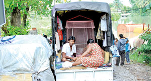
Kolonnawa
“Agriculture, road development, local government, environment, railways, education, police, and disaster management authorities should co-ordinate to ensure the safety of the public and prevent landslides.”
Apart from issuing clearance certificates, handing over rain gauges, landslide hazard zone mapping, creating awareness programmes and research, the NBRO has no powers to take legal action against those who do not obtain the NBRO certificate for constructions, carry out haphazard steepening of slopes or fail to follow proper water management and land use.
Mr. Bandara said residents should report to the District Secretary’s offices if they notice any abnormalities such as rock slides, unusual seepage of water and bulges on slopes.
With the increase of landslides and floods worsening experts have called for better methods in minimising landslides.
Professor Kapila Dahanayake, a geologist from University of Peradeniya, said a mechanism should also be introduced, with the advice of irrigation officials, to harvest floodwater at higher levels without letting almost 80 per cent of it drain out to the sea.
“Concrete columns should be used so that filling the land is avoided while increasing the number of culverts, both to allow the free flow of water,” Prof. Dahanayake said.
The Meteorology Department’s Director of Forecasting, Sarath Premalal, said that after 13 years this week’s rainfall, measuring 450mm, was the highest recorded in the country since the previous maximum of 700mm.
Strong windy conditions over the country and in the sea areas around the island will continue during next few days due to the meeting of wind feeding to the system. There is a high possibility to sudden increase of rain in the south-western part of the country. Very heavy rainfall of 100-150mm is also expected in some areas.
Issues of responsibility muddy the waters
By Sandun Jayawardana
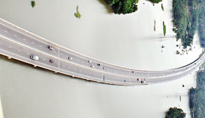
Kaduwela
Colombo’s flooding problem is far more complex than an issue of drainage maintainance, says the chairman of the Land Reclamation and Development Corporation, W.M.A.S. Iddawela.
He said it was easy to claim that the floods in Colombo increased in severity due to poor maintenance of drainage systems, as some were alleging.
“The issue is far more complex and must be looked at from a professional level,” he stressed.
For example, Mr. Iddawela said, the Land Reclamation and Development Corporation was in charge of 44km of the canal system in Colombo. Responsibilities regarding much of the drainage system, on the other hand, lay with the Colombo Municipal Council (CMC).
A collective of several agencies – including the Department of Irrigation, Urban Development Authority (UDA) and Coast Conservation Department – must co-operate to maintain the region’s flood management system, he said.
While the Kelani River bursting its banks greatly contributed to the severe flooding, irregular constructions had heaped enormous pressure on the environment, Mr. Iddawela said. The situation had become unsustainable, he argued.
He cited the Werassa Ganga Development Project, which saw the development of the Bellanwila walking track and surrounding region, as an example of good construction. The project had helped put an end to frequent floods in the Kesbewa and Piliyandala areas. “The project is a testament to how sustainable construction can help mitigate flood disasters,” Mr. Iddawela said.
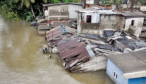
Angoda Pix by Indika Handuwela, Amila Gamage, Anuradha Bandara and Nilan Maligaspe
He said under the World Bank-funded Metro Colombo Urban Development Project, a stronger storm drainage system for Kolonnawa, which has experienced some of the worst flooding to hit Colombo, would be built.
Mr. Iddawela revealed Colombo needed a minimum of 1,000 acres of lowland to safely facilitate water retention in order to avert future flooding in the region. “We have, however, just 600 acres,” he said. “In order to secure the region we have to take steps to find 400 more acres of lowland. That will take a minimum of two to three years.”
He said it was essential to identify all low-lying areas where construction has taken place because they were vulnerable to flooding.
“A major problem is the lack of pumping stations along the Kelani River to pump out excess water,” another official working for the corporation said, pointing out that people living along the flood plains and next to canals have been hit hardest by the flooding, precipitated by heavy rains from May 15-16 that caused a sharp rise in water levels of the Kelani River.
“We have called for tenders on setting up several pumping stations and hope they will be completed by late this year or early next year,” the official, a Deputy General Manager (DGM) of the corporation, said.
She said agencies needed to discuss to what extent climate change was causing such destruction.
Colombo Municipal Council (CMC) Commissioner V.K.A. Anura rejected accusations that the drainage systems under CMC control had not been properly maintained.
“The bottom line is that we have not received this much of rain in Colombo since 2002. We were simply overwhelmed by the deluge,” he said. Mr. Anura likened what happened to having a barrel of water poured on the ground at once instead of a tap being turned on.
The Municipal Commissioner conceded the drainage system in Colombo was extremely old and in need of urgent renovation. He said several projects were underway to improve the system but these would take up to two years to complete.
Department of Irrigation Director of Irrigation (Assets Management and Disaster Management) H.M. Junaid said heavy rainfall in areas upstream such as in Deraniyagala, Kithulgala and Hanwella had contributed to the rise in water levels along the Kelani River.
He said the main concern for authorities was that the water level in the river was continuing to fluctuate as heavy rains in these areas continued.
While many of the affected who lived next to the river had been living in illegal constructions, Mr. Junaid said he did not believe that illegal constructions or the dumping of garbage had played a decisive role in this particular flood. “The rains were simply too much,” he said.
The Ministry of Megapolis and Western Development has ambitious plans set out to control flooding in Colombo.
Tenders are to be called soon to construct two underground tunnels to take rainwater to the sea as a long-term solution, Ministry Secretary Nihal Rupasinghe said. He pointed out there were currently only four main outlets to discharge Colombo’s rainwater. These are located at Wellawatta, Dehiwela, Nagalagam Street and Mutwal.
When the water level of the Kelani River rises to this extent, however, these outlets cannot cope with the volume of water. Flooding also forces authorities to stop discharging water from Nagalagam Street, which is an outlet to the Kelani River.
Mr. Rupasinghe estimated it would take roughly another two-and-a-half years for the tunnel system to be put in place to control the rainwater more effectively. He stressed improvements to the drainage system was being done in the meantime in areas such as Kolonnawa and Grandpass.

