Arts
Hiking up the Holy Mountain in the off-season
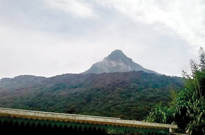
A hike in the off-season to Adam’s Peak, that lofty peak of mystery so admired for centuries by adventurers both local and foreign, is an adventure never to be forgotten.

Adam’s Peak: Mysterious mountain
There are two main trails to Adam’s Peak – the Ratnapura-Pallabaddala trail and the Hatton-Nallathaniya trial with many off-route trails joining at various locations to the main two routes. We selected the Kuruwita- Erathna trial, which is the third most popular route.
This trail begins at Adevikanda in Erathna and runs through 10 km of wilderness, reaching the Ratnapura route 2km before the summit at Galwangediya.
My friends Minol, Shemal and I planned the hike for the third weekend of July. Our plan was to start early on Saturday morning and reach Galwangediya by evening, camp the night there in one of the shelters and ascend the summit on Sunday morning and come down through Nallathaniya.
So meeting up at Pettah, we took the Ampara bus to Kuruwita at 5:15 a.m., reaching there by 7:10 a.m. Next we hopped on the Kuruwita-Erathna bus, which left at 7.30 a.m. Winding its way up the small road it went directly to the trail head Adevikanda by 8.15 a.m.
Gearing up and starting the GPS we began the hike to the Holy Mountain. The trail is clear all the way to the top but the GPS would allow us proper time management aided by the waypoints from the Lakdasun trail guide.
Walking 100m down, the road turned to a small footpath running through disturbed forest with a few houses scattered around.

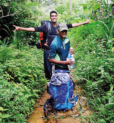
On the jungle trail
From here it is a continuous climb with regular flat sections ending up on top of Warnagala rock, a distance of approximately 3.4 km. At certain places the path is broad with steps, the rest a forest path.
We applied the chemical Alum on our shoes to protect against leeches which worked to some extent. The water sources were plenty and a drink from a stream was like water from heaven.
About 2.3km into the hike we reached the bridge which runs over the façade of Warnagala rock and from here the path led to Warnagala falls. Crossing over, the climb became intense and about 50m up we came to the Dimondgala Ambalama. It was only 11 a.m. but we decided to have our lunch here.
About 100m past the Ambalama we came to the intake basin of the hydro-power plant down in the village. Just after this is the Saman Devalaya.
Here the first person we encountered on this hike, warned us to be careful of the water levels when crossing the Seethagangula.
Reaching the top of Warnagala we turned back to see the bird’s eye view of the endless mountains of the Peak Wilderness. From here the path transformed into a narrow footpath through virgin forest.
This 1.5km walk through the forest was simply amazing. Coming out of this Eden we arrived at the Seethagangula. The time was now 1.55 p.m. so after resting here for a while we prepared to cross the freezing waters.
There was a wire from end to end so taking off our shoes and holding the wire we crossed one by one. We did it with ease as the water level was low but it almost froze our feet.
Once on the other side we put on our raincoats as it had started to drizzle. From here the climb became really steep with the rocky path snaking its way up the hill through thick forest.
Yet despite the tiring climb it was brilliant, the gloomy rainy weather through the forest. By 4.10 p.m. we reached the small Madahinna temple with its Ambalama, roughly 2.5km from the river.
Just in time as it poured! Waiting for about 20 minutes till the rain ceased we set off again. Climbing the steep path we reached the flat plain with the large bedrock known as Indikatupana about 1 km from the temple.
By now the mist was setting in. From here on a clear day one could witness a beautiful sunset with the square-shaped Kunudiyaparwata Mountain in the background but today we could not see 10 feet.
Resting here a bit near the ruined Ambalama we began the last phase of our journey for that day, reaching Galwangediya. Hiking up the misty steep ladder of rocks we finally reached Galwangediya at 6.15 p.m. which was 1 km from Indikatupana.
Now it was nearly dark and even though there were lamp posts along the Erathna trail, they are only lit during the season. At Galwangediya there was a shop all closed up and I stayed there while Minol and Shemal scouted for a proper Ambalama to camp for the night.
To our great relief we met a person who was the watcher at Galwangediya and he warmly welcomed us strangers into his small bungalow to spend the night. In this freezing night this was heaven.
Waking up early to the freezing morning we got a glimpse of our destination: there right in front of the house we looked to the dark blue sky and noticed a dark background with a high pinnacle; it was the mysterious Samantakuta or Adam’s Peak.
We left at 5 a.m. Joining the Ratnapura trail and with our head lamps lighting the way we began the final 2 km ascent to the summit. We intended to catch the sun rise from the summit but the climb took some time.
Climbing the Mahagiridamba was tricky as there was thick mist, nothing could be seen and the wind was so severe that at one point we just clung to the railings. Finally at 7:40 a.m. we made it to the Uda Maluwa of Samanalakanda but no sun, clouds or mountains could be seen.
Sadly the area to the Sacred Footprint was closed so after resting here for about 20 minutes we made our way down to Nallathaniya.
Reaching there by 11.40 a.m. we took a three-wheeler to Maskeliya, before catching the bus back home. It was simply amazing to be one with nature in this splendid mountain away from civilization.

